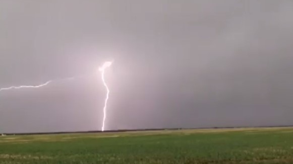
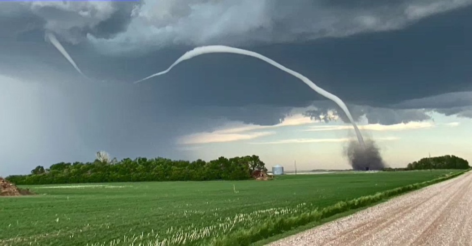
SASKATOON -- Three tornadoes emerged from a storm system that swept through central Saskatchewan Tuesday night according to Environment and Climate Change Canada (ECCC).
"The storms developed rapidly late in the day ... and very quickly produced three different tornadoes," said ECC warning preparedness meteorologist Terri Lang.
"They were relatively close together, one sort of between D'arcy and Fisk, and then another two closer to McGee."
She said the strength of the tornadoes is being assessed.
Lang also said there were reports of funnel clouds and hail around Rosetown. She said a funnel cloud is only considered a tornado if it touches down and results in damage on the ground.
The tornados and funnel clouds were spawned from a line of systems that quickly developed, according to Lang.
"It was actually quite dramatic and they exploded on satellite pictures that was actually amazing to watch," Lang said.
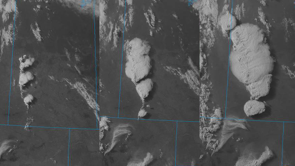 (Environment Canada)
"They can go from absolutely nothing to a massive storm in less than an hour."
Lang said the same weather system was behind a "very nasty" storm in Prince Albert Wednesday morning.
"Very strong winds, nickel-sized hail, flooded streets," Lang said.
She said the storm knocked out the ECCC weather station in the city so rainfall estimates weren't available.
Lang said June and July are "prime tornado season" in Saskatchewan and that it's important to keep safety in mind.
She said a basement offers the best protection from a tornado.
However, an interior room away from doors and windows will work if heading downstairs is not an option.
"Most people are killed or injured by flying debris so you want to get yourself safe," Lang said.
'SIGNIFICANT' DAMAGE
SaskPower spokesperson Joel Cherry said Tuesday evening's storm knocked down some poles in the Harris and Zealandia areas.
He said power would likely be restored by 4 p.m. Wednesday.
Cherry said there was also "significant" storm damage in Carrot River, Red Earth and Shoal Lake First Nations, Tobin Lake and Cumberland house.
Cherry estimated power would be restored between 2 and 6 p.m. in those areas.
"We are also assessing storm-related outages in the Prince Albert area," Cherry said.
The system's brief but powerful encore in Prince Albert included a violent dump of hail and resulfted downed limbs.
Near Zealandia, Dawn McKenzie knew the storm was serious when she heard a rain barrel holding 25 gallons of water get flipped by the winds.
A quonset and all 17 cow pens were destroyed in the storm.
With the price of lumber soaring, McKenzie expects it to be an expensive fix.
“The days are already full, it’s not like we have extra time to do things. But you just put one foot in front of the other and keep on chugging,” she told CTV News.

(Lisa Risom/CTV News)
Dramatic images captured by many
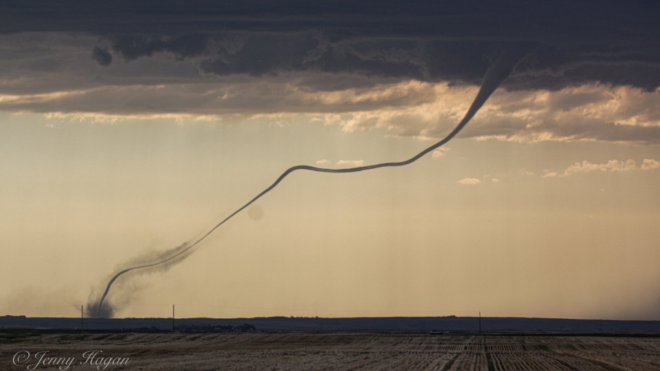
Several images of funnel clouds, one which appeared to touch down, were spotted in west central Saskatchewan Tuesday night.
A video and several photos were posted online, appearing to show a long funnel cloud touching down east of Kindersley just before 6 p.m.
Severe thunderstorm warnings were issued for a number of areas throughout the province Tuesday, however, most had been lifted by midnight.
The Gateway Mall parking lot was left flooded after a June 16, 2021 storm. (Lisa Risom/CTV News)

A still image from a video Brennan Barklay recorded near Rosetown.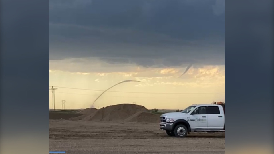
A photo taken by storm chaser Jenny Hagan near Brock, Sask. (Twitter/@LostinSK)
A still image taken from a submitted video recorded near D'arcy, Sask.

A still image from a video captured by Shane Armstrong during the storm.
